
We've closed out the 2023 Year of the Trail, but our trails are open and ready for you to explore!
Explore our Trails
Each of Wake County Parks, Recreation and Open Space’s eight parks and three preserves feature unique trails that wind through diverse habitats. Whether you’re looking for a quiet stroll through the woods, an exciting mountain bike ride with friends or a peaceful paddle surrounded by cypress trees, Wake County has a trail for you.
American Tobacco Trail
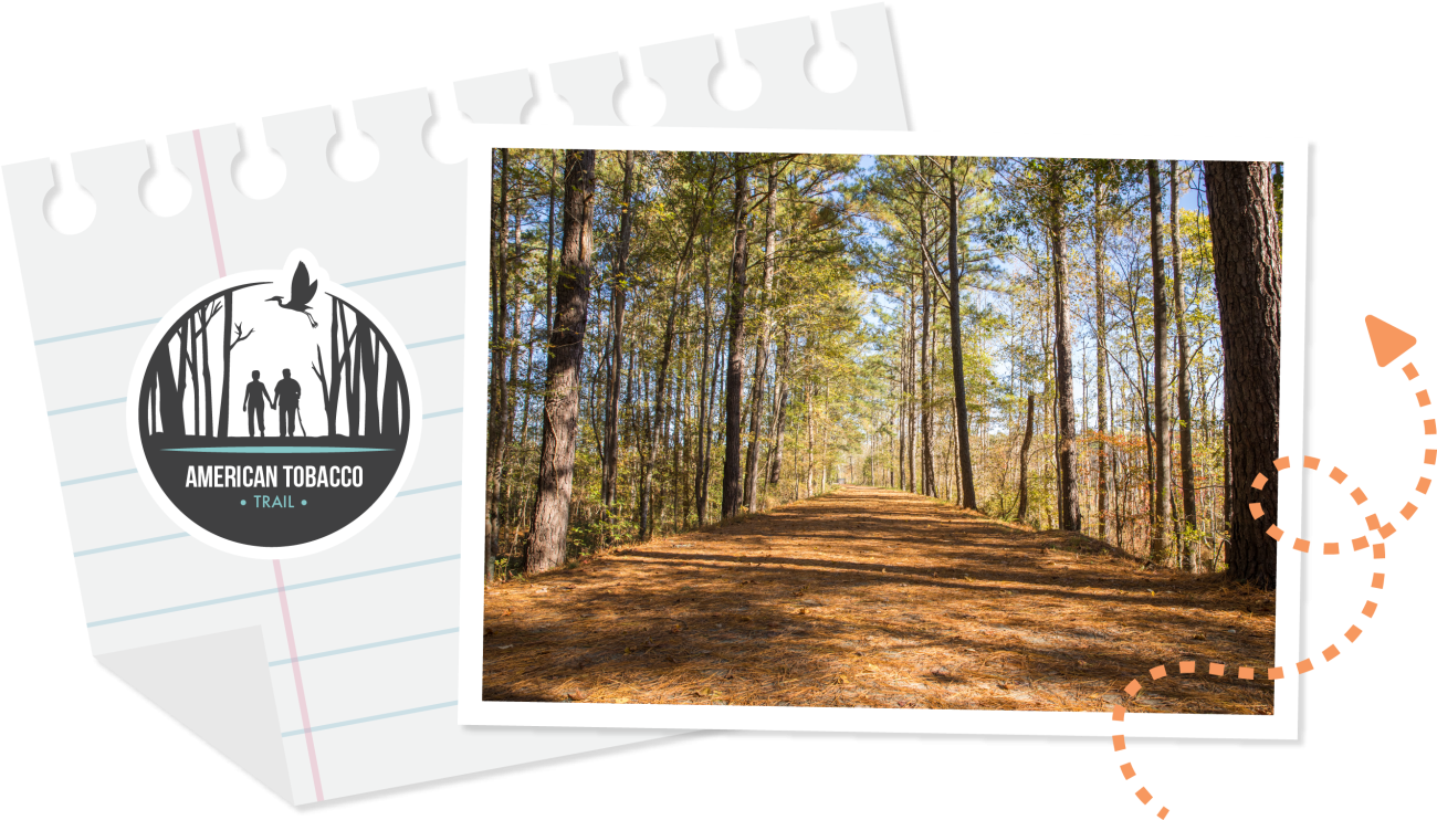
The American Tobacco Trail project converted an abandoned railroad into a multi-use trail system that covers 22 miles from New Hill to downtown Durham. Wake County’s portion of the American Tobacco Trail offers a quiet and rural setting traversing 6.5 miles from the community of New Hill in southern Wake County to the Chatham County line. The trail, which celebrates its 20th year in 2023, is open to walkers, runners, bicyclists and equestrians.
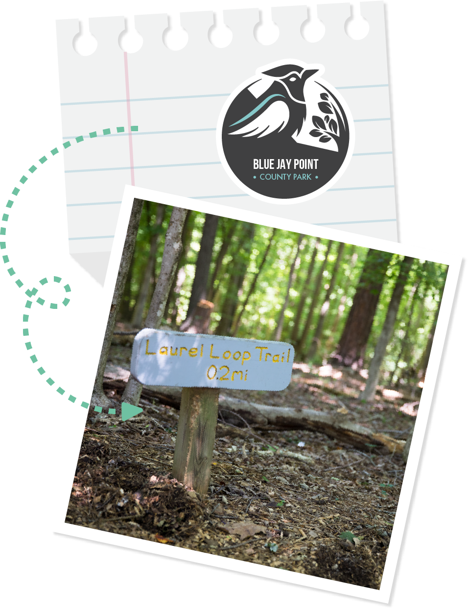
Blue Jay Point County Park
From short strolls to longer hikes, you’ll find the perfect trail where you can clear your mind and strengthen your body.
Point trails are wide and mulched/gravel and go down to Falls Lake.
- Blue Jay Point – 0.5 mile
- Beaver Point – 0.4 mile
- Sandy Point – 0.2 mile
Loop trails are wide and mulched.
- Sparkleberry Loop – 0.3 mile
- Laurel Loop – 0.2 mile
- Azalea Loop – 0.5 mile
The Falls Lake Trail is a single-track, natural-tread trail that meanders 3.1 miles within the park. It’s part of the longer Mountains-to-Sea Trail.
The Garden Loop is a paved trail that travels around the park’s education garden.
Crowder County Park
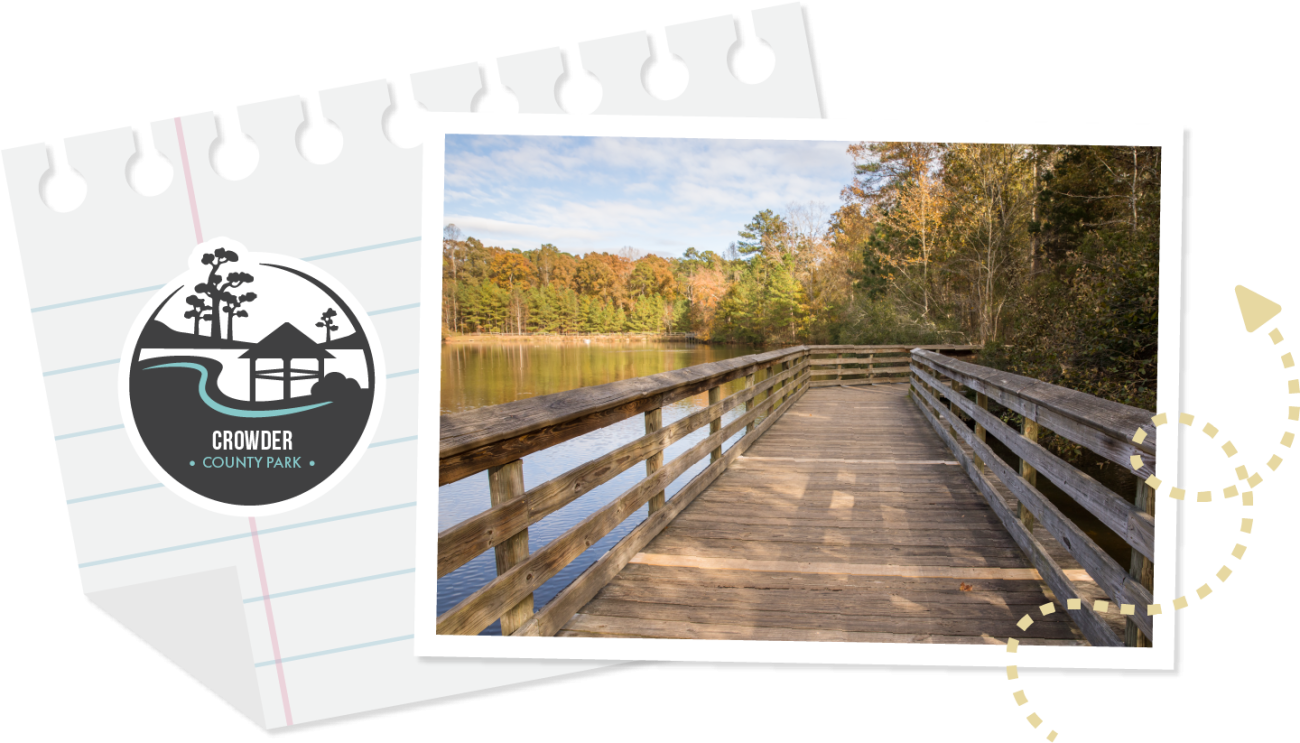
Take a relaxing stroll along trails that wind through wooded areas of the park and circle Crowder’s 2.7-acre pond. Put them together and you have a perfect loop for running or walking!
- Outer Loop Trail – 0.8 mile
- Pond Loop Trail – 0.3 mile
- Cooper’s Hawk Trail – 0.2 mile
Green Hills County Park
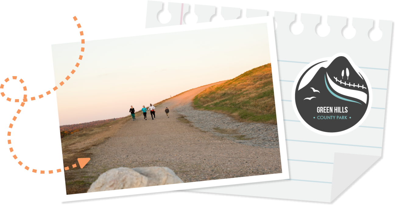
The first trail you’ll see when you arrive at Green Hills County Park is the 1.4-mile Pedestrian Loop. Perfect for your favorite form of mobile exercise, the Pedestrian Loop encircles the big hill and is safely separated from vehicular traffic by a concrete curb.
If a great view is what you’re after, take the 0.7-mile Top of the Hill Trail to – you guessed it – the top of the big hill! Climb to the top of the hill (469 feet above sea level) and you’ll be rewarded with a nice view of the surrounding area – including downtown Raleigh. Park at the Front Entrance parking lot and follow the concrete road to the right to access this trail.
The Nance Spring Loop Trail is a wide, half-mile paved trail around the smaller landfill mound.
Green Hills also features two miles of natural Multi-use Trails for hikers and mountain bikers.
There are multiple places to connect with the Abbott’s Creek Trail, which hooks up to the Neuse River Trail — all part of the Capital Area Greenway System.
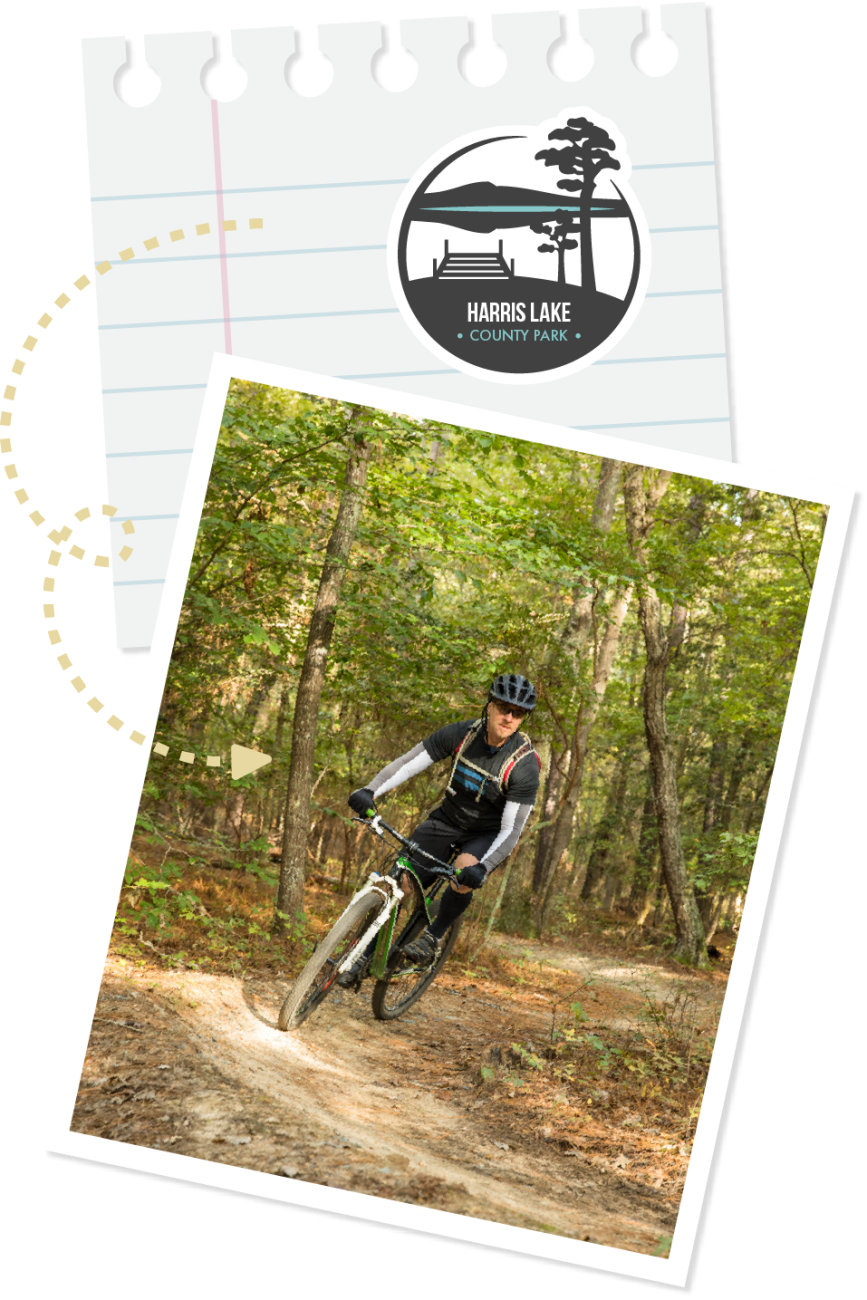
Harris Lake County Park
Explore a variety of forest habitats, wind your way around old farm ponds and hike along the shores of Harris Lake on the 5-mile Peninsula Trail. This trail may take the average hiker 2 hours to complete. The trail head starts at the kiosk near the family picnic area and car-top boat launch. A single blaze indicates the main trail route, and a double blaze indicates a side loop off the main trail.
Looking for a shorter walk? Try the Day Use Trail, which is made up of paved pathways around the day use area (0.3 miles) or the Cypress Tree Trail, a mulch trail that circles the cypress pond (0.2 miles).
If mountain biking is your thing, check out the Hog Run Biking Trails with more than 10 miles of trails for all skill levels. The Hog Run Biking Trails are named for the ditches and gullies formed many years ago from livestock traveling back and forth from the pen to the watering hole.
- Beginner (0.7 mile): Get a taste of mountain biking on this relatively flat trail with few obstacles. The loop is signed for one-way, counter-clockwise traffic only.
- Intermediate (2.9 miles): Designed to challenge mountain bike riders with average skills and experience, these sections feature a narrower riding tread and more changes in elevation.
- Advanced (7.1 miles): Experienced bikers can test their skills on this series of sections offering different routes and more challenges, including a Black Diamond Area and Flow Trail.
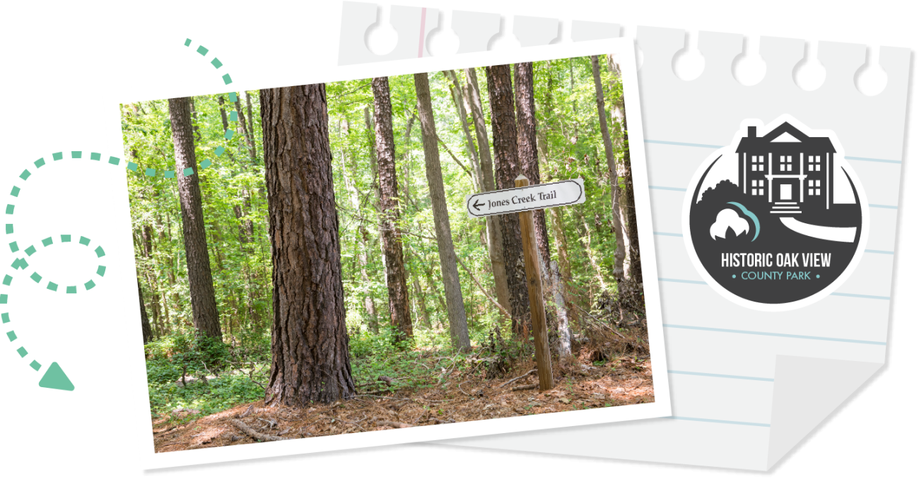
Historic Oak View County Park
Historic Oak View's Hunnicut Trail meanders through a forested area that was once a pasture for the dairy barn at Oak View. The 0.4-mile trail is an easy loop on fairly level ground with a path wide enough to accommodate strollers. The entrance is located off of the trailhead that begins on the north side of the Farm History Center parking lot.
The Jones Creek Trail is an easy-to-moderate dirt trail that follows the Jones Creek, then wanders through a cedar and pine forest before returning to the creek. It is not stroller-friendly. The entrance is located off of the trailhead that begins on the north side of the Farm History Center parking lot.
Historic Yates Mill County Park
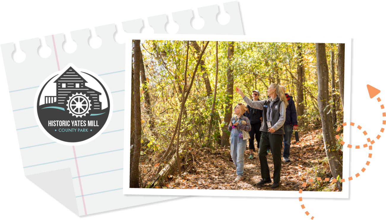
Historic Yates Mill County Park's Mill Pond Trail is a 1-mile, easy-to-moderate walk. The includes an accessible gravel pathway to the mill, a stone ramp to a low bridge over the creek (this may be closed during flooding), stone steps through the old miller’s residence area and the pond boardwalk.
Please note that the Mill Pond Boardwalk will be closed for renovations during part of winter 2023. Visitors who wish to access the High Ridge and Creekside trails on the other side of the pond will have to walk on the Mill Pond Trail past the gristmill first. To return back to the parking lot, you will need to retrace your steps, which will make the walk longer than normal.
If you're looking for a more strenuous walk, the 0.8-mile High Ridge Trail is for you. This naturally surfaced linear trail travels along the ridges above the pond through mixed old field pine, hardwood forests and north-facing bluffs. When combined with part of the Mill Pond Trail, the trail length can be extended to a 1.25-mile loop.
The Creekside Trail is a 2-mile linear trail that crosses over several wetland areas by way of footbridges and wooden walk-boards. After a short loop at the end of the trail, hikers will retrace their steps back to the boardwalk for a total of 2 miles. Please note that this trail is subject to flooding and can be wet in the winter.
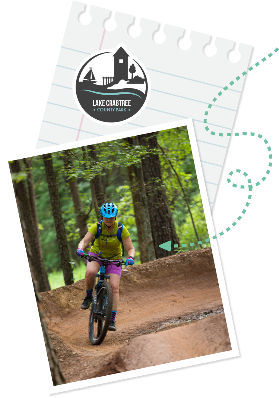
Lake Crabtree County Park
Enjoy the scenery along the six-mile Lake Trail. Blue blazes mark this loop, which features the Heather Lee Carr Memorial and Black Creek footbridge. A portion of the trail is shared with the Town of Cary’s Black Creek and Crabtree Creek greenways. The trail may take the average hiker 2.5 to 3 hours to complete. Portions of the trail are also used by bikers.
The 0.6-mile Old Beech Nature Trail is a short loop that provides a self-guided environmental education experience. Learn about habitat features as you travel from a young mixed forest to an older bottomland forest. A brochure is available at the trailhead kiosk.
Designed for the beginner to intermediate rider, the park’s 9.4 miles of Multi-Use Trails are used by mountain bikers, joggers and walkers. The trail system can also be reached from the Town of Cary’s Black Creek Greenway or from William B. Umstead State Park via Old Reedy Creek Road near Interstate 40.
The park also features a 5.5-mile Paddling Trail, which makes a loop around the shoreline.
Robertson Millpond Preserve
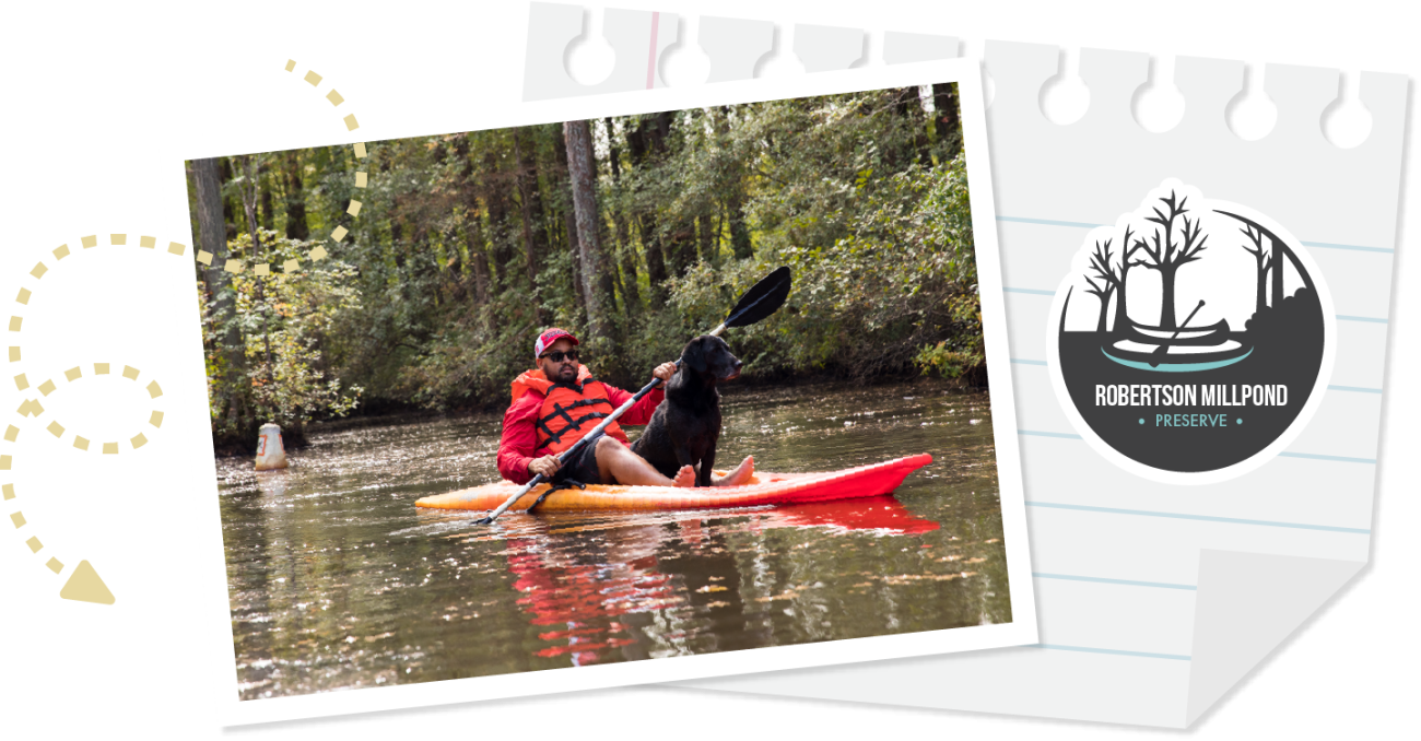
Robertson Millpond Preserve features a 1.15-mile Paddling Trail through a blackwater cypress-gum swamp. The bases of the cypress trees provide habitat for plants, shrubs and vines, including coastal fetterbush and swamp titi. Many birds, beavers, muskrats, amphibians, reptiles and fish live in the swamp. Kayaks are available to rent on the weekends between Mother’s Day and the first weekend in August. Visitors are welcome to bring their own kayaks, canoes or stand-up paddleboards any time the preserve is open.
No boat? No problem. Enjoy a short walk from the old dam out to an observation dock and around a paved loop.
Sandy Pines Preserve
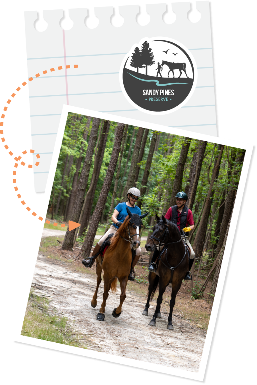
Wake County’s newest preserve, Sandy Pines Preserve, offers 6.5 miles of walking and equestrian trails through a variety of habitats featuring pine forests, mixed hardwood-pine forests, creeks, a pond and many open field areas.
Sandy Pines Trail is a 1-mile, crushed stone screenings trail running north and south. It connections to all trails.
Enjoy a 0.7-mile trot along the Longleaf Pond Trail, which will take you to the pond where you can fish for smaller sunfish and see the Longleaf pine restoration area.
The 2-mile Wandering Fields East Trail connects many wide-open fields as well as a large lowbush blueberry patch.
The 1.25-mile Wandering Pines West Trail can be added to Wandering Fields for an even longer tail. It connects Loblolly pine forests and the restored Longleaf pine forests.
Take in a 1-mile dose of nature on the Easy Gait Trail.
Appreciate the towering hardwood trees along the southern portion of the 1.6-mile Horseshoe Trail.
Several connector trails will allow you travel from trail to trail.
Turnipseed Nature Preserve
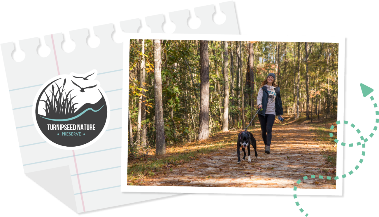
Spend the day exploring Turnipseed Nature Preserve, including its boulders, meadows, open play area and Gin Branch Creek. Hike, picnic and learn about farming history at this unique Wake County preserve.
Take in the best view of the boulders, rocks and sand along the 1-mile Boulder Trail, which is accessed via the half-mile Gin Branch Creek Trail. Relax on one of the many boulders overlooking the creek. Other trails include:
- Lupine Loop – 0.4 miles
- Meadow Loop – 0.5 miles
- Hunt Valley Trail
Take a Mobile Tour

Many of our parks offer mobile tours, which enable people to see our trails in a different way! Each tour will show you a map of the property and indicate significant features and interesting spots to see. When you get to each point, you'll have access to text, audio, photos and/or videos to help you learn more about and explore your surroundings.
You can access these tours while you’re our at the park or while you’re sitting at home!
Greenways
In 2011, the City of Raleigh approached Wake County about partnering to construct the Neuse River Greenway to benefit residents in both the incorporated and unincorporated areas of the county. After this project, Wake County has continued to partner with municipalities on greenway projects under the guidance of the 2017 Wake County Greenway System Plan. To date, we’ve partnered with our municipalities to build 23.7 miles of greenway trails. An additional 3.1 are under construction (Crabtree, Middle Creek, Apex West), and 18 miles are currently in design (Swift Creek, Triangle Bikeway).
More about Year of the Trail
The North Carolina General Assembly designated 2023 as NC Year of the Trail, an effort led by the Great Trails State Coalition. This initiative celebrated North Carolina’s vast network of trails, greenways and blueways, which showcases our diverse landscapes – grand mountain vistas, quiet rivers, vibrant urban greenways, coastal forests and the rolling hills of the piedmont.
North Carolina is the Great Trails State, where each of North Carolina’s 100 counties should be able to enjoy the proven benefits of trails, including health, safety, economic development, tourism, transportation and environment. Trails are the backbone of our state’s growing $28 billion outdoor recreation economy.
The Great Trails State Coalition is a broad-based group of diverse organizations, agencies and supporters advocating for increased state investment in all types of trails statewide: hiking, paddle, mountain biking, equestrian, and paved.