Flood Protection
The current ordinance was revised in 2003 with the intent of restricting fill and development from flood hazard areas.
Wake County seeks to promote public health, safety and general welfare and to minimize public and private losses due to flood conditions within flood-prone areas by implementing ordinance provisions designed to:
- Restrict or prohibit uses that are dangerous to health, safety and property due to water or erosion hazards or that result in damaging increases in erosion, flood heights or velocities
- Require that uses vulnerable to floods, including facilities that serve such uses, be protected against flood damage at the time of initial construction
- Control the alteration of natural floodplains, stream channels and natural protective barriers, which are involved in the accommodation of floodwaters
- Control filling, grading, dredging and all other development that may increase erosion or flood damage
- Prevent or regulate the construction of flood barriers that will unnaturally divert flood waters or that may increase flood hazards to other lands.
Whether you are looking to build on the perfect piece of property or you've just experienced damage from a flood, flood prevention and mitigation is something we should all be concerned with. Wake County's Floodplain & Stormwater Management program provides helpful advice and determines compliance with floodplain regulations in our community.
Flood Hazard Areas are:
- FEMA designated Flood Hazard Areas – Floodway, Flood Fringe (1% annual chance), Future (0.2% annual chance)
- Flood prone soils
- Streams and lakes
- Backwaters from culverts, bridges, road crossings, etc.
Requesting Floodplain Information
To obtain floodplain information for properties in Wake County, determine if your property is located in an unincorporated part of Wake County or a municipality.
Using Wake County iMaps, determine the Extraterritorial Jurisdiction (ETJ).
Once the ETJ is known, reference the Contact List to find the Floodplain administrator(s) within your jurisdiction. Each local government has its own flood ordinance.
A new tool from the State is Flood.NC.Gov or go directly to NC FRIS (fris.nc.gov). Search either site by address for base flood elevations, risk estimates, insurance estimates and more! If you need the adoption date of your floodplain panel, it can be found on NC FRIS or Wake County Effective Map Panels.
Requirements for Development or Construction in Flood Hazard Areas within Wake County
Scenarios that require a Flood Certification or a Flood Study
The requirement for a Flood Elevation Certificate or Flood Study is determined by Floodplain Management staff through site plan review as part of the building permit application process.
- A building lot may have been identified for potential flood hazard during construction plan review and noted with an asterisk *.
- A proposed structure is within 100 feet of flood hazard soils or FEMA flood hazard area.
- There is FEMA floodplain on or adjacent to the lot.
- Development is proposed in or near a stream buffer.
- A road or driveway crosses a flood hazard area.
- Utility lines, power poles and other small encroachments require a Floodplain Encroachment Permit.
Wake County prohibits fill or structures in the flood hazard areas; in addition, structures on flood hazard lots shall be elevated at least 1 foot above the base flood elevation.
Flood Certifications
A Wake County elevation certificate may be required if any construction activity has been proposed within 100 feet of the Wake County flood hazard soils.
All Flood Certifications must be performed by a Professional Land Surveyor and reviewed by Wake County Floodplain Management Staff.
Flood Study
A flood study must be performed if the proposed construction activity involves a roadway, driveway and other encroachments crossing through Wake County Flood hazard soils or FEMA floodplain.
A flood study must be performed by a Professional Engineer or Professional Land Surveyor and reviewed by Wake County Floodplain Management Staff. The flood crossing or encroachment must be evaluated for the 100-year storm. Backwater elevations must be designated on recorded plats or easements.
Floodplain FAQs
Flood Hazard Areas
What flood hazard areas are regulated?
Wake County regulates FEMA Flood Zones (Special Flood Hazard Areas) identified on Flood Insurance Rate Maps provided by the National Flood Insurance Program arm of the Federal Emergency Management Agency (FEMA) AND Flood Hazard Soils Areas identified in "The Soil Survey, Wake County, North Carolina."
Flood hazard areas are shown on the record plat of subdivisions as well as on the construction drawings for commercial areas. Encroachments (fill material, roads, buildings, etc.) into flood areas are strongly discouraged and when allowed must meet rigorous design standards. Flood studies, prepared at the applicant's expense and reviewed by County staff, must show that the proposed encroachment does not adversely affect existing or proposed on-site structures or off-site properties.
FEMA and Flood Soils
Does a FEMA flood zone override Flood Soils?
The FEMA Special Flood Hazard Areas delineations take precedence over the Wake County flood soils designations. Re-mapping of FEMA areas requires modeling and Local, State and Federal approval. Re-mapping of Wake County soils areas requires soil borings by a soil scientist and local government approval.
Flood Soil Types
What soil types are considered to be Flood Hazard Soils?
Soil types designated by the Wake County Soil Survey
| Abbreviation | Soil Type | Slope |
|---|---|---|
| Afa | Altavista fine sandy loam | 0 to 4% slopes |
| Au | Augusta fine sandy loam | 0 to 4% slopes |
| Bu | Buncombe soils | 0 to 2% slopes |
| Cm | Chewacla soils | 0 to 2% slopes |
| Cn | Colfax sandy loam | 0 to 6% slopes |
| Co | Congaree fine sandy loam | 0 to 2% slopes |
| Cp | Congaree silt loam | 0 to 2% slopes |
| Ly | Lynchburg sandy loam | 0 to 4% slopes |
| Me | Mantachie soils | 0 to 4% slopes |
| Ps | Plummer sands | 0 to 4% slopes |
| Ra | Rains fine sandy loam | 0 to 2% slopes |
| Ro | Roanoke fine sandy loam | 0 to 2% slopes |
| Sw | Swamp | |
| Wh | Wahee fine sandy loam | 0 to 2% slopes |
| Wn | Wehadkee silt loam | 0 to 2% slopes |
| Wo | Wehadkee and Bibb soils | 0 to 2% slopes |
| Wy | Worsham sandy loam | 0 to 4% slopes |
Flood Permits
How do I apply for a Flood Study Permit?
Encroachments such as driveway crossings through flood areas require County approval and a flood permit.
You will apply for a permit through the Permit Portal and select "Flood Study."
A flood study must accomplish the following:
- Ensure flood depths are not increased on neighboring properties.
- Ensure the lowest building level is built above the 1% annual chance flood elevation.
- Determine if flood waters will top the foundation pilings/piers under the house during the 1% annual chance storm and required freeboard. If the foundation will be topped by floodwaters (i.e., natural ground elevation at the building site is below the 1% annual chance flood elevation), a special foundation design is required. The foundation must be designed to withstand the various forces it will be subjected to during the 1% annual chance storm event.
- Public roads may not be overtopped; private roads and driveways may not be overtopped by more than six inches during the 1% annual chance event.
Permit Details
What rules apply?
Flood Hazard regulations are outlined in the Wake County Unified Development Ordinance, Article 14. For Flood Hazard Soils Areas; the following rules and procedures apply:
- Encroachments may be exempt if there is less than 5 acres of drainage (may require Professional Land Surveyor check the drainage area and certify that the drainage area is less than 5 acres).
- Flood Hazard Soil Boundaries may be modified by a field investigation by a Licensed Soil Scientist. The report of the field investigation shall conclude with a description of the actual soil horizons that were encountered on the site.
- A flood study may be performed by a licensed design professional (professional engineer, landscape architect or surveyor) to delineate the 1% annual chance floodplain. This is the most accurate way to determine the actual flood limits for a floodplain area.
Note: The options above are performed at the applicant's expense. Wake County Flood Permit fees apply.
For FEMA-Identified Special Flood Hazard Areas, the following rules and procedures apply:
- Flood studies, prepared by a Registered Professional Engineer from field-surveyed information supplied by a Registered Professional Land Surveyor.
- If the mapping error involves an area of high land that was not reflected on the FEMA FIRM maps, it is possible to correct these errors with the assistance of a Registered Professional Land Surveyor only. Changes to FEMA maps require FEMA approval through a LOMA or Letter of Map Amendment.
- The applicant is responsible for the expense of flood studies and LOMAs. There are review fees charged by both FEMA and Wake County for flood studies as well as fees for changes to the FIRM maps, if required.
Building Lots with Flood Hazards
We're interested in buying a lot with some floodplain area that has an asterisk (*) on the record plat of the subdivision. A note on the plat says a Flood Hazard Area Use Permit may be needed prior to issuing Flood Elevation Certifications
Depending on where your house (or other structures or driveway) is located on the lot, a Flood Hazard Area Use Permit as well as Pre- and Post-construction Flood Elevation Certifications may be required. When you apply for a building permit, a flood review is started, and a $50 review fee will be invoiced through the Permit Portal. In some cases, you will need a surveyor to complete elevation certificates.
Elevation Certificates
What is an Elevation Certificate and where can I get one?
A Flood Elevation Certification is a form that is filled out by a Professional Land Surveyor to certify that the proposed or existing structure is either out of the flood hazard soils area or that the low-ground elevation at the structure’s footprint is above the flood elevation (plus safety factor) or flood depth in FEMA-mapped floodplains or flood hazard soil areas where a flood study has been performed.
Elevation certificates may be required before, during and after construction to ensure the home is built at the required elevation.
If you are looking for an elevation certificate for an existing home, your local government may have one on file. If the home was built "Pre-FIRM," you will need to hire a surveyor to complete a new form for your insurance company.
Flood Insurance
Can I get flood insurance if I do not live in a flood zone?
Anyone can get flood insurance. Your mortgage company may require flood insurance if you live in a FEMA flood zone or if the property has a history of flooding. The insurance rate depends on whether your home is in a flood zone and if it is elevated above the flood level.
Wake County does not permit development in flood hazard areas, so there are relatively few flood-insured properties here.
Flood Contacts
Where would I obtain site specific floodplain information for a property?
Wake County's GIS map (iMAPS) has layers for FEMA and flood soils.
You can also consult our Floodplain Contact List and call the Floodplain Administrator for your community. Wake County does not provide floodplain management for municipal areas.
Flooding
What is flooding?
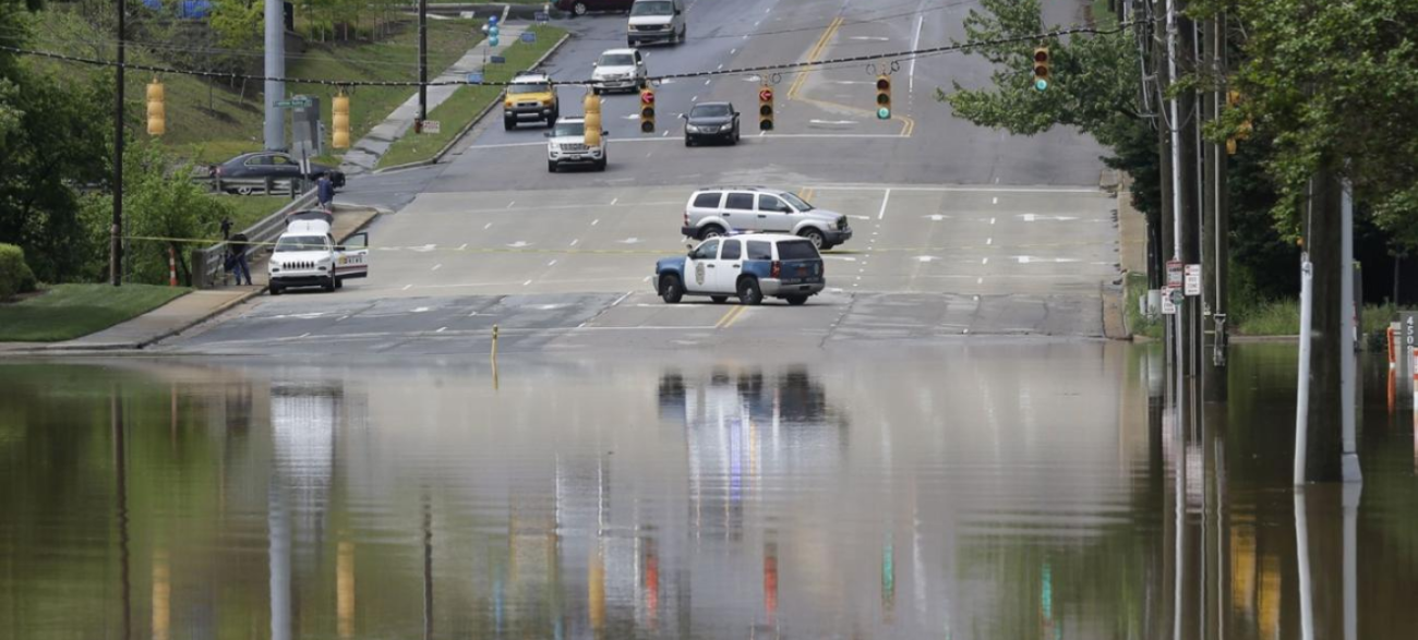
Flooding is a temporary overflow of water onto land that is normally dry. DO NOT DRIVE THROUGH A FLOODED ROAD! TURN AROUND DON'T DROWN!
Floods may:
- Result from rain, snow, coastal storms, storm surges and overflows of dams, clogged drains and bodies of water.
- Develop slowly or quickly. Flash floods can come with no warning.
- Cause outages, disrupt transportation, damage buildings and create landslides.
Yard Flooding
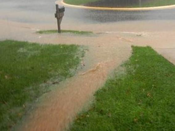
Who is responsible for my yard flooding?
Most yard flooding occurs during high intensity rainfall events. The storms that cause flash flooding of roads also cause streams to overflow banks, storm drains or swales to overflow and water to seek a downhill path across your yard. A 2-inch rainfall over 1 acre of land creates more than 200,000 gallons of water.
Homes in Wake County are designed to have positive drainage away from each house. Water crossing your yard during a heavy rain is part of the normal water cycle. Wake County does not manage drainage to the lot level. The engineer who designed your neighborhood roads and laid out the lots, designed a swale system to carry runoff from roads to low points, usually streams and creeks and established drainage easements to carry water between lots. In newer neighborhoods, runoff flows to stormwater control measures, which mitigate runoff and provide nutrient removal.
If you have structural flooding, you may consider flood insurance. Wake County has restricted development in flood hazard areas since the 1970s in an effort to minimize flood losses to residents. Drainage and landscape maintenance is a homeowner responsibility.